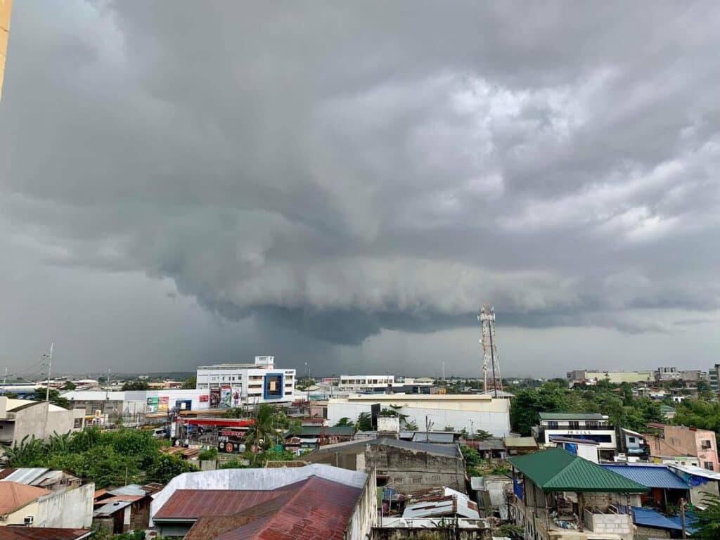
Dark rain clouds hover over some areas of Metro Cebu | FILE PHOTO/Brian Ochoa
CEBU CITY, Philippines — Storm or no storm, Cebu is still in for a wet ride.
Although not directly hit by Tropical Storm Crising, the weather system’s pull on the southwest monsoon (habagat) continues to dump rains across the Visayas, with local weather officials warning of cloudy skies, moderate to heavy rains, and rough seas until Saturday, July 19.
Engineer Alfredo Quiblat Jr., chief of the Philippine Atmospheric, Geophysical and Astronomical Services Administration (Pagasa) Mactan Station, said the weather in Cebu is still being affected by Crising’s indirect impact as of Friday, July 18.
“Indirect effect gihapon sa Cebu. Cloudy skies with katag light to moderate at times heavy nga mga pag-ulan. Winds moderate to strong, kadagatan moderate to rough,” Quiblat said.
(Cebu is still affected by indirect effect. Cloudy skies with scattered light to moderate and at times heavy rains. Winds moderate to strong, seas rough to moderate.)
However, Quiblat added that fair weather would be expected to return over the weekend.
“Ugma and Sunday, we expect improving weather and generally fair conditions,” he said.
(Tomorrow and Sunday, we expect improving weather and generally fair conditions.)
READ: CRISING: Live updates
Schools suspend Friday classes
In anticipation of heavy rains, the Cebu City Division of the Department of Education (DepEd) suspended face-to-face classes in all public schools on Friday, July 18.
The decision followed a memorandum from the Schools Division Superintendent, citing Pagasa’s forecast of sustained moderate to heavy rainfall and possible flooding and landslides within the next 24 to 48 hours.
Cebu City Councilor Dave Tumulak confirmed the announcement Thursday night, noting that classes will temporarily shift to Modular Distance Learning (MDL) as a precaution.
READ: Crising turns into a tropical storm, 8 Luzon areas under Signal No. 2
Tabada: Expect heavier downpour
Retired Pagasa Visayas Director Engineer Oscar Tabada, a trusted weather expert in Cebu, earlier warned that Friday’s rains could be heavier than those that caused widespread flooding across Metro Cebu on Wednesday, July 16.
“What we experienced yesterday, we might experience again tomorrow—or even more—because of Crising’s position,” Tabada said in a Thursday interview.
He explained that when a storm would move close to the eastern side of northern Luzon, it would tend to intensify the southwest monsoon in the Visayas.
“Ugma, gikan buntag hangtod hapon hangtod gabii, duna ta’y kusog na ulan,” Tabada said.
(Tomorrow from morning until afternoon until evening, we will have heavy rains.)
According to him, the previous day’s downpour was caused by a rare weather phenomenon: two consecutive supercell thunderstorms. These storms poured heavy rain over Cebu City for over two hours, with an estimated 150,000 to 300,000 barrels of rain dumped in that short span.
“Sa Cebu City gyud na-concentrate ang thunderclouds,” he added.
(The thunderclouds were concentrated in Cebu City.)
READ: Heavier rains in Cebu expected this Friday – Meteorologist
Safety reminder amid uncertain weather
Tabada urged the public to limit travel and avoid unnecessary outdoor activities, especially in flood-prone areas. “If you don’t have important plans, ayaw lang sa lakaw (Don’t leave). Stay at home to stay protected,” he said.
He also advised residents to stay alert for falling trees or debris, given the strong winds accompanying the rains.
Habagat to ease by Sunday
As of Friday morning, Crising (international name: Wipha) has intensified into a tropical storm, packing winds of up to 65 kilometers per hour and gusts of 80 kph. It was last spotted 325 kilometers east of Tuguegarao City and is moving northwest at 20 kph, according to Pagasa’s 5:00 a.m. bulletin.
The storm has raised Tropical Cyclone Wind Signal Nos. 1 and 2 in parts of northern Luzon but is not expected to make landfall in the Visayas.
Still, Central Visayas, including Cebu, remains under threat of rain until Saturday.
“Until Saturday, we’re still expected to experience moderate to heavy rains,” said Pagasa-Mactan weather specialist Jhomer Eclarino.
“We advise the public, especially those in disaster-prone areas, to monitor weather updates continuously,” he added.
City on alert
Tumulak said weather-related safety assessments were ongoing. He clarified that while class suspensions might sometimes be announced late, decisions were made carefully with input from barangays and DepEd officials.
“Daghan man gyud ta’g i-consider. Dili sayon ang pag-declare og suspension. We only recommend, and they make the final decision,” he said.
(We have many things to consider. It is not easy to declare a suspension of classes. We only recommend and they make the final decision.)
Read Next
Great Job & the Team @ INQUIRER.net Source link for sharing this story.


