“Extreme” wildfires emitted more than 8bn tonnes of carbon dioxide during the 2024-25 “global fire season”, according to a new report.
The annual “state of wildfires” report from an international team of scientists finds that fires burned at least 3.7m square kilometres of land – an area larger than India – between March 2024 and February 2025.
This is almost 10% below the average annual area burned over the past two decades.
But, due to an increase in wildfires in carbon-rich forests, the CO2 emissions resulting from these fires were almost 10% above average.
The report also zooms in on four of the most prominent extreme wildfire events during this time: southern California; north-east Amazonia; South America’s Pantanal-Chiquitano region; and the Congo Basin.
All of these events were found to have been more likely to occur as a result of human-caused climate change.
The researchers identify that, in some cases, the area burned by these fires was 25-35 times larger than it would have been without global warming.
The report also estimates that more than 100 million people around the world were exposed to wildfires in 2024 and 2025.
These fires are “reshaping lives, economies and ecosystems on a global scale”, one of the report authors, Dr Carmen Steinmann from ETH Zürich, said in a statement.
‘Increasing extent and severity’
Scientists from dozens of institutions analyse “extreme wildfires” globally between March 2024 and February 2025 in the second annual edition of the report.
The report explains that the “March-February definition of the global fire season latest global fire season is chosen so as to align with an annual lull in the global fire calendar in the boreal spring months”.
According to the report, the authors “harness and adopt new methodologies brought forward by the scientific community”. They add that in future reports, they hope to “enhance the tools presented in this report to predict extremes with increasing lead times, monitor emerging situations in near-real time and explain their causes rapidly”.
In the report’s “summary for policymakers”, study author Dr Matthew Jones, from the University of East Anglia, says:
“[The report] focuses on the global extreme wildfire events of the global fire season, explains why they happened and fingerprints the role of climate change as one of the key drivers of changing wildfire risk globally.”
The authors aim to “deliver actionable information” to policy experts and wider society about wildfires, the report says.
Using satellite data, the authors find that 3.7m square kilometres (km2) of land burned globally between March 2024 and February 2025. This means that the 2024-25 fire season ranks 16th out of all fire seasons since 2002, indicating below-average burned area compared to the rest of the 21st century.
However, the global fire emissions database shows that the 2024-25 wildfire season drove more than 8bn tonnes of CO2 emissions, according to the report. This is 10% above the average of wildfire seasons since 2002.
Jones explains that this is indicative of a trend towards “increasing extent and severity of fire in global forests, which are carbon-rich”, as opposed to less carbon-rich grassland biomes.
The chart below shows global burned area (top) and carbon emissions (bottom) during the 2024-25 wildfire season, compared to the average over 2002-24, for different world regions. Red bars indicate that the 2024-25 wildfire season had higher-than-average burned area or emissions for the given region, while blue indicates lower-than-average numbers.
Savannas, grasslands and shrublands account for more than 80% of the burned area in a typical year, with forests and croplands making up the rest.
According to the report, burned area in tropical and subtropical grasslands, savannah and shrublands was 10% below the 2002-24 average over 2024-25, but still contributed 70% towards the total global burned area.
The 2024-25 wildfire season was the second consecutive year that African savannahs “experienced a low fire season”, the report notes, with below average burned area and carbon emissions.
Meanwhile, the report finds that the greatest increases in burned area and carbon emissions during the 2024-25 wildfire season were seen in the Canada’s boreal forests, the moist tropical forests in the Amazon region, the Chiquitano dry forests of Bolivia and the Cerrado – a tropical savannah in central Brazil.
The graphic below shows some key figures from the 2024-25 wildfire season.

Study author Dr Douglas Kelley, from the UK Centre for Ecology and Hydrology, told a press briefing that the author team spent time “actively engaging with a big regional panel of experts”.
The team identified four “focal events” – extreme wildfire events that were chosen both for the severity of the fire and the impacts on people and the environment.
For each focal point, the study authors assessed the drivers of the wildfire. They also used attribution – a field of climate science that aims to identify the “fingerprint” of climate change on an extreme event – to determine the contribution of human-caused climate change.
Finally, the authors estimated the likelihood of similar events occurring in the future as the climate continues to warm over the coming century.
Kelley told the press briefing that “capturing fires themselves can be quite tricky”, because they are affected by a range of different factors.
The report notes that wildfires are affected by changes in weather, with hot and dry weather providing the best conditions for wildfires. It adds that changes in land use are also important, as they can affect ignition.
Kelley explained that the report authors used “multiple types of attribution” to capture these different factors, using a range of fire models, weather forecasting models and land use data.
North America
In North America, 2024-25 was an “extreme” fire year, the report says.
Both burned area and carbon emissions reached their second-highest levels since records began in 2002 and 2003, respectively. Across the continent, the burned area was 35% higher than the average since 2002 and the carbon emissions were more than double the average emissions since 2003.
In Canada, 46,000km2 of land burned during the 2024-25 fire season, releasing 282m tonnes of carbon (Mt). The burned area was 85% higher than average, but the associated emissions were more than 200% higher than average, according to the report.
The report also notes that the wildfire season started early in Canada in 2024, due to earlier-than-normal snowmelt, as well as persistent, multiyear drought and “holdover fires” that reignited in the spring after smouldering through the winter months.
In the US, more than 64,000 individual wildfires contributed to a total burned area larger than 36,000km2. More than 8,000 wildfires in Mexico led to a record 16,500km2 of burned area.
The regions experiencing record or near-record burned area and carbon emissions were varied: from the Canadian tundra and the north-western US mountain ranges to California’s grasslands and Mexico’s tropical forests. In the far-northern boreal forest – which contains around 20% of the world’s forest carbon – the season trailed only the record-breaking 2023-24 fire season in burned area and associated emissions.
The researchers select the January 2025 southern California wildfires as one of the four “focal events” of the report.
The maps below show the locations of the four focal events: southern California, the Congo Basin, north-east Amazonia and the Pantanal-Chiquitano. The colours show the percentage difference from the average burned area, with blue indicating less burned area than average and darker browns showing more burned area.
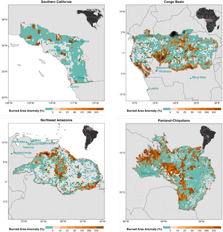
In early January 2025, more than a dozen fires broke out in and around Los Angeles. Although January is “well outside the typical fire period”, the fires “became the most expensive wildfires ever recorded in just a few short days”, Prof Crystal Kolden – a study author and the director of the University of California, Merced’s Fire Resilience Center – wrote in the report.
The two largest fires, named the Palisades fire and the Eaton fire, resulted in at least 30 deaths, more than 11,500 homes destroyed and more than 153,000 people being evacuated from their homes.
The fires resulted in estimated economic losses of $140bn, placing “substantial pressure on the already volatile home insurance market in California”, according to the report. It notes that the fires also contributed to the “housing and affordability crisis” in southern California.
The report says that the severity of the January fires was largely due to intensifying extremes in the water cycle – an unusually wet period that allowed vegetation to flourish, followed by an unusually arid winter that dried out that vegetation, turning it into fuel. It notes:
“Between 5 and 25 January, favourable weather, fuel availability and ignition sources aligned, leading to create ideal conditions for ignition and rapid fire spread.
“The substantial suppression efforts deployed is unaccounted for in our modelling framework and could be one of the possible reasons the fires did not escalate even further.”
Previous attribution analysis found that the January 2025 fires were “likely influenced” by human-driven climate change. The report authors also find that the burned area in the southern California event was 25 times greater due to climate change.
However, whether extreme fire activity in southern California continues to intensify depends largely on how the region’s plants and trees respond to increased atmospheric CO2, the report says. It also notes that climate models disagree as to whether wintertime rainfall will increase or decrease in future climates.
South America
The report finds that South America had a total area burned by wildfires of 120,000km2 during the 2024-25 fire season – 35% higher than average.
That translated into the release of 263Mt of carbon – the “highest carbon emissions on record for the continent” and 84% above average, the report says.
Jones, a study author, said in a press briefing that South America “hasn’t seen carbon emissions like this on record before”.
The report underlines that South America’s fire season was “unprecedented” in many ways, such as fire extent, emission levels, intensity and their impacts on society and the environment, although not in the number of fires.
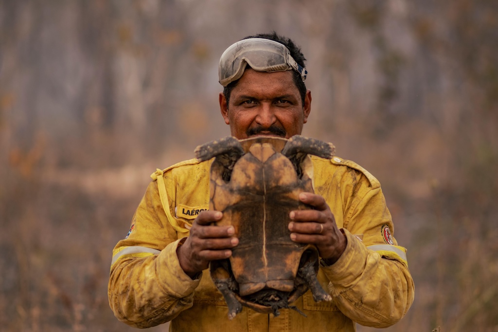
For example, fires in the north-east Amazon impacted air quality, crops, houses and native vegetation, affecting people living in the region, including Indigenous peoples such as the Yanomami, the report says.
The country with the largest area burned by wildfires during the 2024-25 fire season was Brazil, with a total burned area of 243,000km2, followed by Bolivia, with a total of 107,000km2 of burned area, and Venezuela, with a total of 43,000km2 of burned area.
The most-affected biomes in the region were the Amazon rainforest, with 47,000km2 of wildfires above the average since 2002.
Second was the Chiquitano and Chaco dry forests – encompassing parts of Bolivia, Brazil, Paraguay and Argentina. These biomes experienced a “record-breaking” fire season with more than 46,000km2 of burned area. These fires resulted in 100Mt of carbon emissions – six times higher than the average since 2003.
More than 46,000km2 of the Pantanal – the largest tropical wetland located in Brazil, Bolivia and Paraguay – burned in 2024-25, with associated carbon emissions of 67Mt above the average.
According to the report, fire activity in the region was primarily driven by “anomalous dry weather”.
In the north-eastern Amazon, the severity of the fire season between January and April 2024 was compounded by natural sources of climate variability, such as El Niño and the Atlantic Meridional Mode, which contributed to very high temperatures and absence of rainfall. There, deep soil moisture dropped to 1%.
Meanwhile, in Pantanal and Chiquitano, “extreme dry weather” since 2023 and “multiple years of below-average rainfall” contributed to the severe fires, the report says. Study author Dr Francesca Di Giuseppe said in a briefing that the “wet season that usually happens between February and May failed completely to recharge the soil that kept completely dry and this drove most of the fire season” in the region.
The authors conduct an attribution analysis and find that the fire weather conditions in the north-eastern Amazon that season were “significantly more likely” due to climate change. In the Pantanal and Chiquitano, the conditions were 4.2-5.5 times more likely due to climate change.
Africa
Overall, the scale of fires across Africa was “well-below average” in 2024 and 2025, the report finds, except in certain areas, including the Congo Basin, northern Angola and South Africa.
In 2024, a record-high amount of land was burned in the Congo Basin – a biodiverse region in central Africa spanning six countries that holds the world’s second-largest tropical forest. This burned area was 28% higher than the annual average and there were 4,000 fires in total, 20% more than usual, in 2024.
Fires also caused “hazardous” air pollution and contributed to the Congo Basin’s highest loss of primary forest in a decade.
The analysis in the report finds that it is “virtually certain” that human-caused climate change contributed to the extreme fire weather in this region in July and August 2024.
The hot, dry and windy conditions were 3-8 times more likely to occur as a result of climate change and the area scorched by fires was three times greater than it would have been otherwise, the findings show.
Climate change has also driven an increase of more than 50% in the average annual burned area in the Congo Basin, which the researchers say is “one of the most robust signals of climate influence” in the fire trends they analysed.
Drought was a major factor behind the fires, the report finds, and water stress is expected to be the main driver shaping future fires in the Congo Basin.
These fires are “part of a long-term trend of increasing fire encroachment into African moist forests, driven by climate change and human pressure”, says Prof Michael Wimberly, a professor at the University of Oklahoma who was not involved in the report, but has researched wildfires in Africa. He tells Carbon Brief:
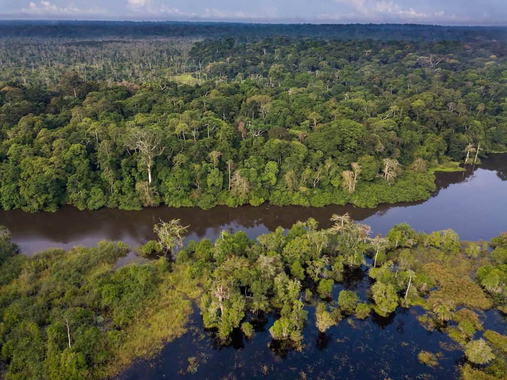
“The increased fire activity in the Congo Basin is troubling because of the vast expanses of unfragmented forests and peatlands that store massive amounts of carbon, provide habitat for threatened species and supply vital resources to local populations.”
The report notes that there is “sparse reporting and poor media coverage” on the impacts of fires in the Congo Basin in 2024, despite millions of people being impacted.
In South Africa, 34 people were killed and thousands of livestock and homes were destroyed in fires last year. In Ivory Coast, 23 people were killed and 50km2 of land was burned.
Dr Glynis Humphrey, a postdoctoral research fellow at the University of Cape Town, who was not involved in the study, adds that a below-average burned area across Africa “does not necessarily indicate a decline in fire risk or impact”. She tells Carbon Brief:
“In some ecosystems, fewer but more intense fires are being observed, which can still have severe ecological and atmospheric consequences.”
Using climate models, the researchers project that fires to the extent of those in the Congo Basin last year could occur up to 50% more often by 2100, under a medium-emissions pathway.
The region is also projected to see more increases in extreme wildfire risk by the end of this century. Gabon, Equatorial Guinea and the central part of the Democratic Republic of the Congo could see some of the largest increases in burned area, which, the report estimates, could double or quadruple in some cases.
Humphrey notes that fire patterns are “shifting” in response to climate change, which is “leading to significant consequences for ecosystems that don’t typically burn – like the forests in the Congo Basin”. She tells Carbon Brief:
“This is of concern, as primary forests harbour critical biodiversity that supports ecosystem functioning and provide services to people…These forests are also sanctuaries for endangered species.”
Great Job Carbon Brief Staff & the Team @ Carbon Brief Source link for sharing this story.

